Showing posts with label not the Appalachian Trail. Show all posts

Friday, June 26, 2020

The Zion Death March


June 27-30/85. Zion National Park, Utah.

A challenging four-day loop in Zion National Park, that’s what we planned. A challenging loop with a near fatal fall for me, borderline hypothermia and sheer exhaustion for us all is what we got. We ended alive and thankful, all too aware of what a close call it was. The years since have not diminished that memory.

Setting out on a pretty summer Thursday in late June 1985, Randy, Greg, Gary and I are prepared to scramble and even swim part of our route down a Kolob Canyon, a narrow side canyon that feeds into the South Fork of the Virgin River. Then follow the river through The Narrows to the main park road. About 25 miles total, all sheer-walled narrow canyon. No place to be during thunderstorms or high water. That’s why we’re here in June; water is lowest and chance of thunderstorms is low. Most people hike the Zion Narrows via a more accessible route from the east. We are taking the route less traveled. We’ve been hiking Arizona and the southwest together for the past few years as members of the Central Arizona Backpackers Association and know each other’s capability well. We’re pretty confident that we’re ready for this trip.

The first day’s walk is nothing surprising for anyone who’s hiked in canyon country. We follow the West Rim trail straight up a thousand feet from the Virgin River. The climb is steep, offering ever more grand views into the dark and deep narrow gorge we will exit three days from now. A side trail takes us out to Angel's Landing, an isolated knob high above the river. The trail is a knife edge with a chain railing that provides welcome support for me. The drop off on either side is precipitous and long. At the landing I can peer straight down at the river far below. Back on the West Rim Trail, we are actually on pavement for the first two miles--the ultimate tourist trail. A ranger passes by on a three wheeler. Vistas from the rim are grand: intriguing and unusually shaped rock stretches off to the horizon. We camp early after a 12 mile day.

Friday begins in the wonderful coolness of early morning but turns tricky early on. We can’t find the route into Kolob Canyon. The ranger at the station above the canyon isn’t much help. That’s typical of the Park Service response to our inquiries on this trip. The rangers at the Backcountry Office were also unhelpful. They told us only that hiking in Kolob Canyon is not recommended and take 75 feet of rope if you go. We have the rope. The rangers had no information about water levels but we know from the route description that water is lowest in late June. We think know the score.

Using dead reckoning, map, compass and, we drop into one drainage and thrash our way through brush to a 100 foot sheer drop. It looks climbable but we rope up to be safe. One by one we climb down to a ledge on belay. Off belay, Gary finds a route to a flat area without rope. I follow but pick a slightly different route that looks a bit easier. I edge my way cautiously down. My toehold breaks. I slide down the rock wall, digging with my hands trying to slow my fall. I don't slow. The canyon edge looms ahead. I drop over the edge with a panicked, “Oh shit!” And just when I know that I am about to die, I land on brush and timber wedged into a narrow defile a few feet below the rim. Rock and debris continue to fall into the canyon as I scramble off the brush to a rock a ledge. I am terrified. Fuck. I should be dead or maimed now.

Gary is first to the rim to see what became of me. I tell him that I’m okay but don’t want to move unless I am roped up. That takes a while as Randy and Greg are still making their way down the first wall. Once they are down and I am secured to a rope, I easily scramble out, shaken and scared. I lay back to regain my composure.

For all of the drama and sphincter-puckering fear, it turns out that this is not the correct route. We climb back up the wall and find a rest spot. I debate whether to continue. My fall left me banged up and shaken but not seriously injured. My partners offer to walk back the way we came. I regain my composure and decide to continue. I don't really want to walk back on the West Rim. We try another route. The right one this time. We chimney down a rock chute. My back and hips are sore from the fall but I make the descent with little trouble. We can hear Kolob Creek below us but encounter another drop. We're hungry and tired; the day is late so we make camp. It's been a long, long day. Tomorrow will be better, walking a slot canyon with swims around a couple waterfalls. Maybe even fun. For better or worse, the only way out for us now is down the canyon and out through The Narrows.

Saturday we reach Kolob Creek and find lots of water, far more than we expected. It looks like we'll be in water far more than we planned. We pick our way along the banks and encounter lots of brush that makes for slow going. I wish I had an internal frame pack--my external frame snags on everything. Now we're in the creek. The water is cold and the creekbed is rocky. Damn, this is fucked. We come to our first waterfall. We toss our packs (with gear thoroughly encased in plastic) over and jump behind them. I plunge into the water but cannot float with my heavy boots and parka filling with water. I call to Gary for help and he pushes my pack over to me. I grab on for life and make the shore, wet and cold. Little sun filters into this narrow canyon to warm us. We keep our warmth by eating and burning energy as we pick our way down the canyon. We've got to make it to the Virgin River by nightfall; camping in a narrow canyon like this is very risky, even in good weather.

At the second waterfall we are looking at 50 or more feet of sheer-walled canyon with water sluicing through it after we negotiate the fall’s 20 foot plunge. Greg comments dryly, “Shouldn’t we be hearing 'Dueling Banjos' about now?" Uneasy laughter breaks the tension and we set about negotiating the waterfall. We lower Greg using the rope. He lunges out from under the waterfall on his backpack, paddling and kicking furiously as he tries to break free of the roiling water at the base. Then he's gone. He reappears in a second attempt as futile as the first. Undertow! We hoist him back up and rethink our approach.

Some previous hiker anchored a D ring to the rock at the top of the waterfall. Someone in our group--not me--knows how to rig the rope on the D ring so we can retrieve it. We tie other end of the rope to Gary's pack and heave it over the fall and beyond the undertow. The pack floats down the narrows where it snags on rocks at the narrows' end in calmer water. We tug on the rope and find it snug. Gary lowers himself through the waterfall and begins pulling himself down the narrows. Randy, Greg ad I pull the rope taut so he can keep his head above the churning water. He reaches his pack, ties the rope around his waist,anchors himself against the rocks and stretches the rope taut over the narrows.

I follow. Wearing gloves, I put my weight on the rope, expecting to drop into the water like Gary. Instead, I find myself suspended above the maelstrom and quickly haul myself hand over hand through the narrows to shallow water. What a ride! I would never have thought myself up to it. Amazing what necessity will do. Greg and Randy send the rest of our packs down the rope using carabiners. I retrieve the packs and then the others follow. We retrieve the rope, having rigged it so cleverly. We're wet and cold. We fire up the stoves and drink hot water.

That was the last of the two expected jump and swims but we're still in water from here on, picking our way around rocks and debris. The water is ankle to waist deep. And cold. The day is getting late and we have no idea how far till we reach the Virgin River. Only hope is to keep pushing on. But we can't. We're hungry and light is fading. No choice but to camp and hope. We find a spit of sand large enough for us all and fall into place. Despite the all the water today, our gear is dry. We eat and crawl into our bags uneasily. I'm close enough to the stream that a drop of water occasionally splashes into my face, making me think rain. I can't see the sky so I don't know what the weather will be like. I sleep fitfully despite physical and mental exhaustion. During the night Greg drills a hole in his big toenail to relieve the pressure of a blood blister from a banged up toe.

Sunday morning we are battered, tired and almost out of food. Yesterday's effort consumed much of what we had. I begin the day with a freeze dried omelet, a granola bar and a Slim Jim. Not much for what will be a long day's walk. Gary has a bagel and some gorp as we leave camp so he seems well supplied by comparison. We reach the North Fork of the Virgin River after a short hike. Thank god! Now just 8 more miles to the entrance to the narrows and the end of our route. No waterfalls on this leg but water is high in places, much higher than in Kolob, with chest deep wades and a few swims. Bottom rocks are much slicker here so footing is tough. I fall a lot; each time getting up is more difficult. I eat the last of my food around mid morning. Greg drinks the last of his maple syrup. The day is long, hard and endless. The narrows are starkly beautiful: dark, sheer walls rising a thousand feet or more overhead. Little sunlight reaches us as we pass through. I can appreciate the beauty of this place but what I really want is out of here.

After a few hours wading, swimming and falling, I see two guys sunbathing on a large rock in the middle of the river. Day-trippers! The end can't be far! But the day-trippers were ambitious and the remaining distance is farther than we think. Time drags. Energy is low. My body is battered, beaten and banged. My legs have been flayed by a million thorns, brambles and branches. I look thoroughly flogged. Moving is an effort but I have no choice. I manage somehow. We are all hungry and tired. We use our remaining strength to plod on and encourage each other. More people! A ranger followed by a camera crew asks if we saw a Girl Scout troop upstream. I think of all the places where this group of six-footers had to wade and swim and hope those Girl Scouts are holed up somewhere or went out the way they came in.

Finally we are nearing the end. The canyon opens up and is becomes increasingly crowded with people enjoying the water on this bright, sunny day. We pass by like specters from another dimension. We shiver in our parkas and strain to walk. I am far removed from these happy frolickers in their swimwear with air mattresses, children and video cameras. All I can think about is pain and the difficulty of taking each step. I am beginning to warm up in the sun but feel like I will never be really warm again. We reach the end of the trail and collapse. Randy hitchhikes back to the truck. We are out! I am alive.

After the hike, I am laid up for about a week, moving with great difficulty. That’s when the enormity of it all hits me. By all rights I should be dead. Surviving that fall was sheer luck. And the desperate scramble down Kolob Canyon could have easily killed any of us from hypothermia. The fact that I am alive to ponder all of this is no relief from the shock and fear. The following weeks are very sobering.

Sometime later I hear from Greg. Looking at map during the hike we all noticed that upstream from the point where we dropped into Kolob Canyon was Kolob Reservoir. Greg managed to track down the dam operator to inquire about water releases around the time we were in the canyon. We had expected about 5 to 7 cubic feet per. Greg learned from the operator that releases had been increased to around 35 cfs just prior to our hike, which explains why we encountered so much water. Had we known about that—the backcountry office never said anything about water releases—our plans would likely have changed; our pre-hike information warned about the danger of hiking in the canyon during periods of high water. I like to think we were sufficiently smart to act on that information had we known. As it was, we were very lucky. Sure, we brought a certain amount of skill to the whole affair but luck was surely with us.

Later hikers were not so lucky. Once again Greg found the story, this time in the Salt Lake Tribune.  In July 1993 a group of 13 teenagers and three adults rappelled into Kolob Canyon and encountered high water. The two most experienced leaders died shortly after entering the canyon as they tried to get past a plunge pool. That would be the first waterfall we encountered not long after we reached the creek on Day Three. The surviving adult did not attempt to go forward and huddled with the hungry, cold teens in a small alcove beneath a cliff to await rescue, which came five days later.T he Salt Lake Tribune story reported that the water flow was 28 cfs. Once again I was reminded my good fortune eight years earlier.

I never fail to marvel at my good fortune.


Thursday, May 21, 2020

Around This Time in 1980


Ramsey's Draft, Virginia.  May 20-24, 1980

First extended solo trip. Well, my dog Toby is with me but he and I are the only domestic species in the woods. We just hiked into Sexton shelter via the Shenandoah Mountain Trail off Route 250. Got in late on a Tuesday evening. I had to brief a legislative committee on a report and didn’t get out of Richmond until after noon. Then I had to return home to get my wallet. You know, city things. Once on the road, though, the trip west was pleasant. Ran into some showers driving up along the way but mostly the rain held. The hike in was was nice but my pack, loaded with gear for an extended base camp, was a real bitch. The sky was partly cloudy but I got a few glimpses of the late afternoon sun.
 
Morning One dawns cool, cloudy and damp. Weather reports called for rain throughout today and evening. Clearing tomorrow. Sexton Shelter provides wonderful solitude, accompanied by the sounds of birds and a babbling brook, Jerry's Run. Saw a hummingbird a while ago. Trees are almost leafed in, but not yet fully. A few dogwood trees still show blossoms. Mountain laurel has yet to bloom. Maybe I'll see that happen on this trip. I wander back up to the ridge to explore. Don't want to be too far out if rain hits. Early going is nice. And if I read my position correctly, I'm a good ways toward Hardscrabble Knob. Bet I can do the entire loop. Even if I get wet, it won't be for long. But later on the trail deteriorates, brush and fallen timber make for slow going. Raining now, steady and hard. Where is that knob? It can't be too far. I camped there a couple or so years ago, came up Ramsey's Draft. It didn't seem that far then. [Note: This is my first recorded instance of Hiker's Amnesia, a cerebral impairment that transforms a previous hiking experience or memory into a less difficult physical task than it actually was. See also: Gila Wilderness 1984 for an example of memory loss in a three day period.] I make Hardscrabble Knob. Finally. It's socked in with rain and cloud. I hunker in the remains of a shelter with Toby. We eat and head down the Ramsey's Draft Trail. Thank fucking god.

Almost home now. A known distance, if I am still willing to trust my distance judgment after faking myself into a long, wet hike. The trails are pretty well marked although I always wonder if signs leaning against the bottom of the post point in the right direction. At least on this trail I know. Work my way down Ramsey's Draft (see Sep 26/77 for previous hike). Emphasis on work. Trail is steep and slippery. The grand experience of the gorge is overshadowed by my focus on getting back to the cabin. Numerous stream crossings. Not too bad. Toby and I are both soaked, we couldn't get any wetter. At last!! The cabin. I change clothes, towel off myself and Toby. Time to eat. Fire up the wood stove. I remember to build a small fire in the vent pipe to start the draw from the firebox. Arrange clothes and gear ritually around the stove. Now I sit on the porch listening to the rain fall. How nice it sounds now that I am warm and dry. I can hear the stream flowing beside the cabin. Bet it will be running high for the next few days. A bird sings in the distance. Despite the hardships of the day's hike, I enjoyed myself. Not that I wasn't anxious at times. The area is truly gorgeous: sheer ravines carved by strong running streams which at times take over the trail. I like it here. I can think of no place else I would rather be.

Day Two is easy. Legs and butt are a bit stiff after yesterday's long walk but they don't hurt. Slept late and ate a big breakfast. No rain this morning. Wrote a letter and cut firewood. Everything is dry now, even my boots which felt like sponges yesterday. Just thinking about the rain reminds me that I thought I would never be dry again. But the evening was nice. The stove worked well. I sat on the porch listening to the forest in the rain, enjoying the solitude. Sexton Shelter has a logbook that provides an entertaining look at those who came before. Two newlyweds spent their honeymoon at the cabin not long ago; they met on a club hike to this place the previous year. Many entries discuss the resident mice. One describes a major engagement between humans and mice complete with charges, feints, counter charges, retreats and body counts. Another writer describes the large wood stove as a very particular woman, liking her logs hard, dry and fast. Green wood need not apply.

Day Three is lazy. I head down the Jerry's Run Trail with the idea of hiking to Hardscrabble Knob via Ramsey's Draft. Jerry's Run is high and crossings are tricky. Ramsey's Draft is even higher. I'm not willing to make the crossings so I return to the cabin and bathe in one of the nearby pools. Get bitten in a most uncomfortable place. Cut wood to replace what I've used. The trip has been great one. I'm completely at leisure and the world is very far away and means little to me at this place. Late afternoon sun filters patches across the clearing. Jerry's Run is rushing strongly and birds are singing. The beauty of this place is entrancing. All around I see the inevitability of nature at work. Mighty trees felled by onrushing waters. Generations of fallen timber gather moss in steep ravines. Mosses, lichens, ferns and fungi grow everywhere, swaddling the ground in a carpet of green. A shattered tree, about three and a half feet in diameter, lies across the Jerry's Run Trail broke upon impact, its splintered pieces still intertwined. This place feels eternal.

Day Four is departure day. I pack reluctantly. Who wants to leave a paradise like this? The morning begins with drizzle which ends before I set out. Only takes an hour and a half to reach the car. My pack is considerably lighter than coming in but I am carrying out a lot of excess food. Drive into Monterey, a small town nestled in the ridges of the Alleghenies. The town has a genuine air of antiquity--well preserved with its old buildings still in use. A statue of a Confederate soldier stands in the town square, the first one I've ever seen outfitted with a bolt action rifle.


Friday, May 22, 2015

Late Spring Velo News


This spring, my eighth in Olympia, is the earliest spring I've experienced since moving here in late 2007.  We've had sunny, warm days--perfect cycling weather--since April.  For that matter, winter was pretty mild.  No snow whatsoever, less rain and even the occasional warm sunny day.  Combine that with a three-day work week since January and I've had plenty of opportunity to ride my bike.  The four day weekends give me a much better shot at taking advantage of the sunny, dry days which have a habit of occurring on weekdays rather than weekends.

Since I'm often riding twice a week my rides are shorter but the total mileage those usually totals around 35 miles, although last week I broke 40 miles.   Heading toward the end of May and I'm already more than halfway toward my annual goal of 1040 miles.  I'm still figuring out new, shorter variations of my established routes and have explored a few new routes along the way.

Today's ride was near perfect.  The temperature was in the high 70s with mixed cloud cover.  The early part of the ride was sunny, later on partly cloudy.  I started out in a light polypropylene shirt--didn't need a jacket at all--but changed to a t-shirt before an hour was up.  That makes the first time I've cycled in a t-shirt this year.  I cannot remember doing that in any previous year.

None of this is any assurance that warm, dry weather is here to stay.  After riding in my polypro shirt and just shorts for a couple of weeks in early May, I went out in wearing a jacket and tights.  I warmed up enough to remove the tights but it was a cooler ride than I had been used to.  As a rule I don't count on reliably warm weather until July.  Hell, in 2011 spring didn't arrive until July.   But this is not a normal year.  The governor has already declared a statewide drought emergency due to the extremely low snowpack--only 16 percent of normal--and we're seeing unusually warm temperatures.  The 10 day forecast has minimal chance of rain.  Again, not normal for late May.

All that said, the biking in Olympia has been great so far in 2015. 

Monday, March 30, 2015

Blog News

This space has been pretty quiet the past few months.  All my writing effort since January has been going to drafting the final version of my Vietnam memoir.  I've been downloading as much as I can remember of my year in Vietnam and pulling together work dating back to the 70's to see what story I have to tell and what would make it worth reading to anyone.  Maybe it will be nothing more than getting it on record.  Right now it's nothing that merits publishing that hasn't already been published at Unsolicited Opinion, my original blog.  Two of those posts, One Day and One Night, sum Vietnam up for me.    

With all that I've not had much to say, either here or at Unsolicited Opinion.  I'm also not entirely sure what to do with this blog.  It began as a marketing tool for a my book about the Appalachian Trail so it's trail- and outdoors-oriented.  But I also think it's about books and writing, topics that may take me away from trail topics at times.  So far, I haven't come up with a good balance or clear pattern that makes for frequent and sustained writing in this space. 

One of my favorite sources for copy are my trail journals.  Coming up in April is the 10th anniversary of my Missing Miles AT hike in 2005.  I plan to blog my journal from that hike off and on between April and June.  That may kick start something here.  Not long after I finish blogging the Missing Miles is the 30th anniversary of the Zion Death March.  I will tell that tale then.  We'll see where things go from there.

Hope you enjoy the journey.

Sunday, October 19, 2014

Oh Wow. Look at the Moon

Stepping on to my balcony to scan the pre-dawn sky I catch the fleeting image of a waning crescent moon as it disappears behind some fast-moving clouds.  What I saw was pretty--early morning crescent moons always are--so I wait to see if I get another look.  The clouds look pretty dense against the dark sky but after a couple of minutes patch of light appears in the dark and soon the crescent was visible again.

This morning's crescent is a delicate sliver of light on the edge of the moon's disc which is darkly illuminated by earthshine.  A very light haze gives the sky a soft focus so the crescent's image is gentle stark.  The look is suitable for a morning crescent.  It holds my interest.  I scan the separation between light and dark on the disc.  I follow the deep curve of of light and linger on its points, happy just to see this moon and morning sky.

The clouds return.  Slowly at first, hiding then revealing some or all of the crescent.  A brief final tease before dropping the curtain on this performance. 

Saturday, August 9, 2014

Not Too Hot August Velo News

Western Washington has had the longest run of sunny, warm and occasionally hot (over 90) weather this summer.  Today is predicted to be one of the cooler days (84) but mid-day temperatures and high UV make cycling less pleasant than I care for, especially if I have an alternative.  Which I do:  mornings.   The temperature was 50 when I got out just after sunrise today, around 7:00.  That's higher than some mid-afternoon temperatures during winter, so I can deal with it easily.  Still it was chilly enough that I was comfortable wearing a jacket over a long-sleeved shirt first couple hours of the ride.

Since much of the year here does not lend itself to early morning rides, I enjoy the chance to get out early during the summer.  It's a habit I developed out of necessity riding in Phoenix.  I soon learned to enjoy the empty streets, the low light  and the quiet.  During summer in Olympia I get a chance to indulge my fancy.

This morning offered some fine highlights.  Heading east on 33rd Avenue I could see the road undulating under a green archway, the strong morning light filtering through the foliage.  The scene recalled summer mornings hiking the Appalachian Trail and reminded me how luck I am to be out on a beautiful morning like this.  Returning over Woodard Bay I stopped to watch the tide going out.  A sea otter head popped up in the water, then several more.  I saw six total and from the slightly larger size of one and the way the others followed its lead, I'm pretty sure it was a mother and six pups out foraging.

The day was beginning to warm up by the time I reached the northern end of the Chehalis Western Trail at 9:00.  Enough to shed the jacket for the final nine miles.  The air was still cool, though, since much of the trail is still shaded.  I never broke a sweat and felt strong throughout the ride:  25 miles and home by 10.  A good way to to start the weekend.

Wednesday, April 9, 2014

A Local Note in the International News

The BBC paints a decidedly unflattering picture of Aberdeen, Washington on this 20th anniversary of the death the town's most famous son, Kurt Cobain ("Kurt Cobain's hometown no 'nirvana' 20 years after death").  That Cobain left a mixed legacy in his hometown isn't very surprising, given the circumstances of his childhood, the limits of life in a small town, his negative comments about Aberdeen as a celebrity, his drug use and suicide.  Being a dead rock legend doesn't count for a whole lot for many folks in Aberdeen.  If it counts at all, it's for the possibility of tourist dollars.

I can't speak to Cobain's life, his music or death--I was well into folk and folk-influenced rock and paid only passing attention to Cobain, Nirvana and the grunge movement.  On the other hand, I have been to Aberdeen more than once and can't say that the BBC is too far off the mark.

Among the very first references to Aberdeen I heard from a native Washingtonian was "Aberdump" and while others weren't as overtly negative, most people don't have much good to say about the town which is about 50 miles west of Olympia.  My first view of Aberdeen took me through a downtown that was more remnant of a better economy; I'd passed all of the big box stores on the highway east of town.  Lots of empty retail space.  Houses small and worn looking.  Neighboring Hoquiam looked equally forlorn.  Gray skies only heightened the effect.  The BBC rightly notes that Aberdeen has been hit hard by the decline of logging and it shows in the empty buildings.  On a larger scale, Aberdeen just looks like it's been used hard.  The city's waterfront is extensive and built out for an economy that no longer requires it.

Aberdeen does have a few things to recommend it, though.  The city is located at the head of Grays Harbor Bay at the confluence of the Chehalis, Whiskah and Hoquiam Rivers, all of which make for a dramatic coastal setting.  Most of my experience of Aberdeen has been passing through on my way to the grand places of the Olympic Peninsula; however much the area may be diminished by the "march of progress" it retains much of its innate beauty.  The approach from the east along Route 12 follows the north side of the broad flood plain of the Chehalis River with its many sloughs and wetlands.  Aberdeen is home to Grays Harbor Institute where Maggie and I heard Melissa Harris speak.  Aberdeen is home port for the Lady Washington, Washington's semi-official tall ship.  Three drawbridges span the Whiskah, Chehalis and Hoquiam Rivers.  A ray of local economic hope is the construction of the pontoons for the new floating bridge in Seattle.  I even ate good Mexican food at an Aberdeen restaurant.

If you look closely you can see Aberdeen's positives but you can't ignore it's decline.  For as much as Aberdeen disdains Kurt Cobain, the BBC would not be writing about Aberdeen but for Kurt Cobain.

Monday, February 17, 2014

Okefenokee Journal

You saw the photos, here's the whole story.


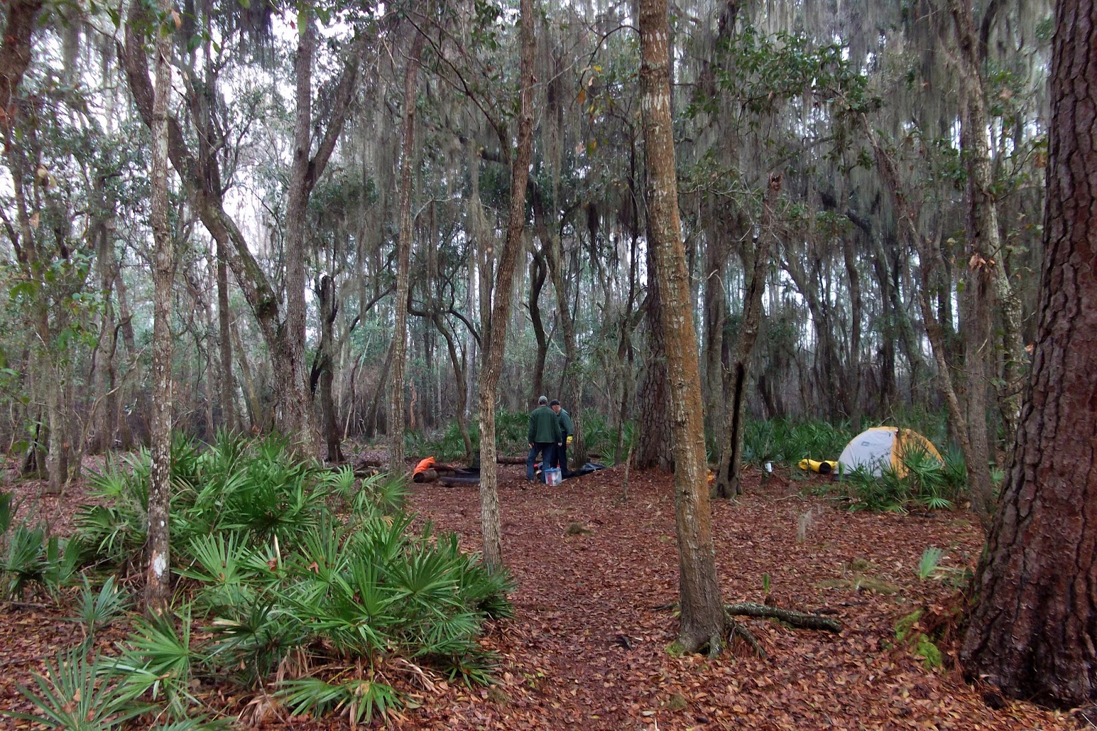
Even this far south, at the Okefenokee National Wildlife Refuge in almost-Florida southeast Georgia, the temperature is in the low 30’s.  Much better than the sub-freezing Atlanta snowmageddon we passed through to get here but still cold for sitting in an aluminum canoe on a foggy morning at Stephen C. Foster State Park.  Maggie is in the bow.  My brother Neil and long-time friend Peyton are alongside us.  I try to remember how to steer a canoe. 

We make our way out a short canal to an open, wide channel of the Suwannee River.  I practice paddling and steering from the stern, figuring out how to coordinate with Maggie paddling from the bow.  Our route is a simple: follow the Red Trail 9 miles up the Middle Fork of the Suwanee River to Big Water Lake (an interesting term for describing an interior feature of a very large swamp which also has prairies), camp on the platform there Friday night, return on the Red Trail, paddle 2 miles past the state park channel on the Suwannee to camp on land at Mixons Hammock Saturday and return to Stephen C. Foster park on Sunday. 

The trail turns north into a narrow channel that follows the Middle Fork of the Suwanee.  The cypress trees are close in as we pick our way around brush and debris here and there.  Everywhere I look is water, yet vegetation is so dense that it almost seems like land.  White herons are everywhere.  Some blue herons and snowy egrets, too.  We reach the rest stop at Minnies Lake after after two-and-a-half hours.  We’re paddling about a mile-and-a-half per hour against some current and occasional headwind.  Steady but not fast.

The sun comes out as we leave Minnies Lake.  With just over five miles to go, we should be in 4:30-5:00 at the latest.  More birds, this time a pileated woodpecker and cormorants.  No alligators sited, though.  We pass Milepost 22 and soon spot a trail sign that says “Shelter” with an arrow pointing in the direction we are headed.  Camp will be soon.  I’m ready.  My butt is sore and my arms are tired from paddling.  Besides we only have about an hour or so of light to make camp and dinner.  I’m ready to be in now.

But no shelter comes into view.  We keep paddling, looking hard for signs of a man-made structure.  Passing Milepost 21, I begin to get that uneasy feeling I had hiking when I thought I might have missed a turnoff to a shelter.  In this swamp, there’s no alternative—no land to camp on if we don’t find the shelter.  The thought of sleeping in the boats chills me in more ways than one.  I paddle with determination.  After another 20 or so anxious minutes, the platform comes into view, much to everyone’s relief. 

We land and begin making camp.  The platform has a vault toilet and a sloped roof over about half of the space.  Peyton’s tent is at the far end in the open.  Neil’s in the middle under the roof.  Maggie and I are on the opposite end in the open.    We are using a rental tent and must figure out how to set it up.  It’s a free standing REI Half Dome with a fly that works best staked in four directions.  I manage to stake the vestibules on each side wedging the stakes between the platform planks.  Dinner is fast.  A few stories, some discussion about the difference between actual trail miles and map mileage (probably due to the recent relocation of the shelter), hot chocolate and to bed.  Sky is partly cloudy but open enough to see Jupiter rising in the east.

A rain shower begins after midnight.  One or two more follow.  Owls hoot in the wee hours.  At first light the platform is wet but no rain is falling.  All around I see swamp enveloped in fog, dark waters dissolving into mist and sky.  This is one of those epiphany moments when I am both in wonder of the experience and the good fortune in life that brought me here.  Yesterday’s long paddle is fully justified in this moment. 

Another shower during breakfast but it ends quickly and we are able to pack up dry.  We bail the boats using my tent sponge in lieu of the more traditional car wash sponge which we don’t have.  We’re on the water by 10:00, expecting rain.  Maggie and I are first out and spot an alligator lying in the tall grass on the far side of the channel.  Occasional patches of fog hover on the water.

Although we are following yesterday’s route, its reverse is every bit as challenging and interesting.  Despite expectations, no rain falls.  The current is with us—nice for cruising down an open straight stretch, not as nice when cautiously trying to thread a canoe under brush and around logs.  I think I have mastered the basics of paddling and steering a canoe but it’s still awkward at times.  Fewer birds are out this morning it seems.  We spot a red tailed hawk perched high when it calls out as we approach.  It watches us as we pass under and away from it.  Woodpeckers drum back and forth.

Lunch is on the platform at Minnies Lake.  Across the channel a white heron is methodically hunting in the tall grass.  A solo kayaker passes by heading north and returns shortly.  He’s the first person we’ve seen in over 24 hours.  Peyton loans me his kayak paddle to try out.  The technique is different but I quickly understand how it allows for steering without the loss of momentum that comes with the steering movements of a single paddle.  I understand that but in a few tight spots I wish I had a single paddle.  Back on the Suwannee, I can crank out easily with the kayak paddle.  We encounter a flotilla of Boy Scouts, not all of whom fully control their canoes.  Signs point toward the Suwannee River Sill and Cravens Hammock. 

Not seeing Mixons Hammock among the destinations leaves us a bit uneasy after last night’s extra distance.  We know we’re heading in the right direction and keep paddling.  We pass a vulture tree—a cluster of trees, actually, with 40 to 50 vultures roosting.  Another sign points the route the Sill and Cravens Hammock through a narrow channel.  Since it’s the only option we follow it and after a few twists and turns we spot a sign for Mixons Hammock on a cable suspended across the entry to the dock. 

No shelter here—just a dock with toilet and a short boardwalk to solid ground.  The campsite has a fire ring and some marginal sites.  It’s surrounded by skinny trees supporting a moss-draped canopy.  The underbrush has a lot of the low palm plant that is so prevalent in this part of the country.  Maggie and I fully stake out the tent and rainfly.  The tent leaked a bit last night at the head and foot because water got between the ground cloth and tent floor.  Dinner is a more leisurely than last night.  Peyton gets a fire started but it never gets going strong due to the wet wood.  Still the smoke keeps the few mosquitoes at bay.  I make pesto tortellini for all.  The two day old crescent moon hangs low in the western at the end of twilight. We’re up a bit later tonight but it’s still an early evening

Sunday morning is foggy and wet.  Tent didn’t leak but there’s much condensation inside the rainfly and lots of moisture on the exterior.  I’m happy that I’m not sleeping in this tent tonight. 

Heading out, fog lies low on the water in places.  Neil and Peyton are far enough ahead that their wake is not evident---we have glass-smooth water ahead.  We pass the vulture tree.  Vultures are roosting and flying on both sides of the channel.  A few fly overhead.  Maggie spots an alligator.  This one is mostly submerged—only its eyes, nostrils and a bit of tail are visible above water.

Soon we reach the channel leading back to Stephen C. Foster State Park.  We pull in before noon.  Neil and I grab a quick shower at the campground.  Now it’s time to find some food that someone else will cook while we sit at a table.  Then back to Atlanta.


Sunday, February 9, 2014

Tuesday, January 14, 2014

Ancient Arts

Saturday evening I attended an event at the Olympia Library about typewriters.  Jim Hair of Blue Moon Camera (they also deal in vintage typewriters) in Portland came up to talk about typewriters, their history and their (somewhat) renaissance.  I have a fondness for typewriters since it was the typing class I took in high school that landed me the company clerk job after five months humping the boonies as a rifleman in Vietnam.  Never mind my college degree--it didn't do diddly for me--but knowing how to type was literally a life saver.

People brought in their manual typewriters to show.  There were some pretty bizarre antique machines as well as more "modern" ones.  There was also a typing contest where contestants typed copy for three minutes.  The sound that was loosed in the building when 10 or so people all began to type was amazing.  I can't recall the last time I heard the clatter of keys like that.  I typed in the second round.  I managed 70 words with 21 errors.  The winner typed 108 words with fewer errors.

Since then I've been playing around with my 1941 Royal Quiet Deluxe.  The keys have a presence that you just don't get from a keyboard.

The event reminded me that I'd heard an orchestral piece that mimicked the sound of a typewriter at some point.  This being the internet age, I quickly found a few videos of  Leroy Anderson's "The Typewriter" only it was not a mimic--the piece features a real typewriter.  The musicians look like they are having a good time.
 

Sunday, December 15, 2013

A December Hike


13-14 December 1993.  GaliuroWilderness, Arizona.  Late afternoon at Powers Garden.  This trip repeats one of my earliest Arizona hikes.  Seemed easier this time.  Experience and conditioning probably.  Came in with Gary from Deer Creek, starting about 12:30 after driving down from Phoenix.  We made good time walking--got in around 5:30 but had to set up and eat in the dark.  December days are short on light.  The trail was generally good and not hard to follow although it was hard for me to match the actual terrain to the topo map.  We had lots of good views to the north and saw some pretty spectacular sandstone cliffs at the junction of Horse Canyon and Rattlesnake Creek.  Deep pools in the area would be inviting if they are still here in the summer.  Powers Garden is much as I remember, a very lush riparian zone.  The long night is cold; I'm pushing the limits of my gear. 

Morning is colder still and slow to warm.  Little sun reaches this canyon till later in the day.  We eat and rig up before shedding our outer clothing.  The trail leads down Rattlesnake Creek for about a mile.  We step over frost covered leaves.  The climb up the flanks of Kennedy Peak warms us up--the day is clear and cool but the sun is warm.  We take several leisurely breaks as we climb, especially toward the crest where  much of southern Arizona comes into view.  We pass through patches of snow descending the north side of the ridge.  The terrain is open here as we begin the final descent to Deer Creek. As we wonder about some trail uncertainty, we encounter an unsigned junction and after make what proves to be a correct choice.  Now we're back on the rolling terrain encountered at the hike's start, completing our loop. The late afternoon light here provides a spectacular highlight to the red outcroppings and the grassy foothills.


A contemporary account